Advanced Groundwater Exploration Technologies: Integrating Geophysical Methods, Remote Sensing, and Artificial Intelligence for Sustainable Water Resources Management in Indonesia
Toward Sustainable Groundwater Management with a Multidisciplinary Framework of Geophysics Remote Sensing and Artificial Intelligence in Indonesia
Reading Time: 28 minutes
Key Highlights
• Technology Integration: Machine learning and artificial intelligence applications in hydrogeological modeling achieve prediction accuracies exceeding 90% when integrated with traditional geophysical methods, transforming groundwater exploration efficiency[1]
• Vertical Electrical Sounding: VES methods remain the most cost-effective and reliable technique for aquifer characterization in Indonesia, with successful applications documented across diverse geological settings from volcanic terrains to coastal zones[19]
• Remote Sensing Advancement: Satellite-based groundwater monitoring using GRACE data and advanced radar systems enables regional-scale assessment of aquifer storage changes, providing critical insights for water resource management planning[14]
• Indonesian Context: Hydrogeological challenges including volcanic geology, seasonal monsoon variations, and increasing water demand require integrated multi-method approaches combining geophysical surveys, remote sensing, and advanced data analytics for effective groundwater exploration
Executive Summary
Groundwater exploration has entered a new era characterized by integration of traditional geophysical methods with cutting-edge technologies including artificial intelligence, remote sensing, and automated sensor networks. Recent research demonstrates that machine learning algorithms applied to hydrogeological data can achieve prediction accuracies exceeding 90%, substantially improving exploration success rates while reducing costs.[1] These technological advances prove particularly valuable in Indonesia, where complex volcanic geology, pronounced seasonal variations, and rapidly increasing water demand create urgent requirements for efficient and accurate groundwater resource assessment.
Vertical Electrical Sounding and geoelectrical methods maintain their position as foundational techniques for groundwater exploration in Indonesia, with documented applications across diverse geological settings from Kupang to Java demonstrating reliable aquifer characterization.[19] However, the integration of these proven methods with remote sensing technologies, GIS platforms, and predictive analytics creates synergistic capabilities that exceed what any single approach can deliver. Satellite-based monitoring systems now enable regional-scale assessment of aquifer storage dynamics, while ground-based geophysical surveys provide the detailed subsurface characterization necessary for well placement and sustainable extraction planning.
This comprehensive analysis examines the current state of groundwater exploration technologies, their application in Indonesian contexts, integration strategies for multi-method approaches, and future trajectories as emerging technologies including IoT sensors and AI-powered interpretation systems mature. The framework presented addresses both technical capabilities and practical implementation considerations relevant to Indonesian hydrogeological conditions, regulatory environments, and resource management priorities.
Vertical Electrical Sounding: Proven Foundation for Aquifer Characterization
Vertical Electrical Sounding represents the most widely applied geophysical method for groundwater exploration in Indonesia, offering reliable subsurface information at costs accessible to most exploration programs. The technique measures apparent resistivity variations with depth by injecting electrical current through ground electrodes and measuring resulting voltage differences, with resistivity contrasts indicating lithological boundaries and potential water-bearing formations. The Schlumberger configuration remains the standard approach in Indonesian applications, balancing depth penetration capabilities with field efficiency and data quality.
Recent applications in Kupang Timur, Nusa Tenggara Timur demonstrate VES effectiveness for mapping aquifer units in volcanic terrains where complex geology creates challenging exploration conditions.[2] The study identified distinct resistivity signatures corresponding to different geological units, enabling prediction of aquifer locations prior to drilling. In Wonogiri, Central Java, VES surveys successfully delineated groundwater potential zones in hard rock terrains, with resistivity values below 50 ohm-meters indicating saturated fractured zones suitable for well development.[4]
The integration of VES with advanced data processing techniques enhances interpretation accuracy and reduces ambiguity inherent in resistivity inversions. Modern inversion algorithms incorporating geological constraints and multiple-electrode array data improve resolution of thin layers and vertical resistivity variations critical for aquifer assessment. Research in Ponorogo, East Java demonstrates how combining VES with hydrogeochemical analysis and geological mapping creates comprehensive understanding of aquifer systems, enabling more reliable predictions of well productivity and water quality.[19]
VES Method Technical Specifications and Applications:
Schlumberger Configuration Parameters:
• Current electrode spacing (AB) ranges from 3 meters to 500 meters depending on target depth
• Potential electrode spacing (MN) typically maintained at AB/5 ratio for optimal signal-to-noise
• Depth penetration approximately 30-40% of maximum AB spacing under favorable conditions
• Recommended station spacing: 50-100 meters for regional surveys, 25-50 meters for detailed work
• Minimum 5-7 sounding points per square kilometer for adequate spatial coverage
• Field crew: 4-6 persons for efficient data acquisition in Indonesian terrain conditions
Resistivity Interpretation Guidelines for Indonesian Geology:
• Saturated alluvial aquifers: 10-50 ohm-meters typical range
• Fractured volcanic rocks with groundwater: 30-100 ohm-meters
• Clay and clayey sediments: 5-20 ohm-meters (confining layers)
• Weathered basement rocks: 50-150 ohm-meters
• Fresh crystalline basement: greater than 200 ohm-meters
• Saltwater intrusion zones: less than 5 ohm-meters in coastal areas
Cost-Effectiveness Analysis:
• Equipment investment: USD 15,000-40,000 for complete VES system
• Survey cost per sounding point: USD 50-150 depending on accessibility
• Typical exploration program: 30-50 VES stations covering 10-25 square kilometers
• Total cost per exploration project: USD 5,000-15,000 including mobilization and interpretation
• Cost per successful well identified: USD 2,000-5,000 compared to USD 15,000-30,000 for exploratory drilling
• Return on investment: 3:1 to 6:1 through reduced drilling failures
Remote Sensing and Satellite Technologies for Regional Assessment
Remote sensing technologies have transformed regional groundwater assessment capabilities, enabling monitoring of aquifer storage changes, recharge zone identification, and hydrogeological feature mapping across extensive areas impossible to survey using ground-based methods alone. Satellite-based systems provide data at spatial scales from hundreds of meters to kilometers with temporal resolutions ranging from daily to monthly, creating time-series datasets revealing seasonal and long-term groundwater dynamics critical for sustainable management.
GRACE (Gravity Recovery and Climate Experiment) satellite data enables quantification of total water storage changes including groundwater at regional scales, with applications across major Indonesian aquifer systems providing insights into extraction sustainability and recharge patterns. Research demonstrates that calibration of satellite soil moisture data with ground measurements can improve groundwater recharge estimation accuracy by 40-60% compared to traditional water balance methods.[6] These approaches prove particularly valuable in Indonesia's monsoon climate where concentrated seasonal rainfall creates highly variable recharge patterns requiring detailed temporal characterization.
Advanced radar technologies deployed from aircraft platforms enable detailed subsurface imaging capabilities exceeding conventional satellite systems. NASA's deployment of advanced radar for tracking groundwater recharge from snowmelt in California demonstrates capabilities applicable to Indonesian volcanic terrains where elevation gradients and complex topography affect recharge processes.[9] Ground Penetrating Radar applications for detecting water-bearing structures in mining and construction contexts provide methodologies adaptable to groundwater exploration in heterogeneous geological environments characteristic of Indonesian archipelago.
Remote Sensing Technologies for Groundwater Applications:
Satellite-Based Monitoring Systems:
• GRACE/GRACE-FO for total water storage anomalies at 300 km spatial resolution
• Sentinel-1 SAR for soil moisture and surface deformation monitoring
• Landsat 8/9 and Sentinel-2 for vegetation indices indicating groundwater depth
• MODIS for evapotranspiration estimation affecting recharge calculations
• DEM data (SRTM, ASTER) for topographic analysis and watershed delineation
• Temporal resolution: daily to monthly depending on sensor and application
Ground Penetrating Radar (GPR) Applications:
• Frequency ranges: 25-1000 MHz with penetration depths inversely proportional to frequency
• Low frequency (25-100 MHz) for deep aquifer mapping to 30-50 meters depth
• High frequency (200-500 MHz) for detailed shallow subsurface characterization
• Effective in non-conductive geological materials (sand, gravel, fractured rock)
• Limited application in clay-rich sediments due to signal attenuation
• Mobile deployment from vehicles or aircraft for rapid area coverage
Integration with GIS Platforms:
• Multi-layer analysis combining geology, topography, land use, and remote sensing data
• Weighted overlay models for groundwater potential zone mapping
• Machine learning classification of favorable recharge areas
• Spatial analysis of well productivity data for aquifer performance mapping
• Change detection analysis for monitoring impacts of extraction and land use
• Web-based platforms enabling real-time data access for stakeholders
Artificial Intelligence and Machine Learning Applications
Artificial intelligence and machine learning represent the most significant recent advancement in groundwater exploration, with applications spanning data interpretation, predictive modeling, and automated monitoring systems. Systematic reviews document that machine learning methods applied to hydrogeological datasets can achieve prediction accuracies exceeding 90% for variables including aquifer productivity, water quality parameters, and seasonal fluctuation patterns.[1] These capabilities transform exploration efficiency by identifying high-potential zones with greater reliability while reducing reliance on expensive drilling programs.
Deep learning applications in hydrogeological modeling incorporate complex relationships between geological structures, hydraulic properties, and groundwater behavior that exceed capabilities of traditional analytical approaches. Research demonstrates deep learning integration into mineral facies modeling and groundwater-surface water interactions, enabling more accurate representation of heterogeneous aquifer systems.[3] The application of GeoAI frameworks combining remote sensing data with advanced machine learning models achieves high-accuracy predictions of groundwater recharge patterns critical for sustainable management planning.
Predictive modeling using machine learning proves particularly valuable for evaluating groundwater fluctuations in arid and semi-arid regions where seasonal variations create management challenges. Studies in regions with climatic conditions similar to eastern Indonesia demonstrate that ensemble machine learning methods combining multiple algorithms achieve superior prediction accuracy compared to individual models.[15] These approaches enable anticipation of water availability changes under different climate scenarios, supporting adaptive management strategies addressing climate change impacts on Indonesian groundwater resources.
AI and Machine Learning Methods in Groundwater Exploration:
Supervised Learning Applications:
• Random Forest for aquifer productivity classification using geophysical and geological data
• Support Vector Machines for groundwater potential zone delineation
• Neural Networks for well yield prediction based on drilling parameters and geology
• Gradient Boosting for water quality parameter forecasting
• Decision Trees for classification of recharge zone suitability
• Ensemble methods combining multiple algorithms for improved accuracy
Deep Learning Techniques:
• Convolutional Neural Networks for automated interpretation of geophysical images
• Recurrent Neural Networks for time-series prediction of water level fluctuations
• Long Short-Term Memory networks for seasonal pattern recognition
• Generative Adversarial Networks for data augmentation in limited-data scenarios
• Transfer learning applying pre-trained models to Indonesian geological contexts
• Physics-informed neural networks integrating hydrogeological principles
Automated Sensor Systems and IoT Integration:
• Real-time monitoring of water levels, quality parameters, and extraction rates
• Automated data transmission via cellular or satellite networks
• Cloud-based analytics platforms for continuous data processing
• Anomaly detection algorithms identifying unusual patterns requiring investigation
• Predictive maintenance systems for pumping equipment optimization
• Integration with decision support systems for adaptive management
Integrated Multi-Method Approaches for Indonesian Contexts
Effective groundwater exploration in Indonesia requires integrated approaches combining multiple technologies to address complex hydrogeological conditions characteristic of volcanic archipelago settings. Single-method surveys provide limited information insufficient for comprehensive aquifer characterization, while multi-method programs create synergistic datasets enabling more reliable interpretation and reduced exploration risk. The integration of VES with remote sensing, geological mapping, and hydrochemical analysis exemplifies approaches delivering superior results compared to isolated technique applications.
Research documenting groundwater exploration in hard rock basins demonstrates that combining geophysical surveys with GIS-based potential zone mapping reduces drilling failure rates by 40-60% compared to programs relying solely on geological indicators.[12] The workflow integrates satellite imagery analysis for lineament identification, digital elevation models for drainage pattern analysis, geophysical surveys for subsurface characterization, and field verification through test drilling. This systematic approach proves particularly valuable in Indonesian volcanic terrains where fracture systems control groundwater occurrence and productivity.
Coastal zone applications require specialized integration addressing both freshwater aquifer delineation and saltwater intrusion monitoring. Studies in Indonesian coastal areas demonstrate VES effectiveness for mapping aquifer geometry and detecting saline water encroachment through characteristic low-resistivity signatures.[1] The combination of time-lapse resistivity surveys, hydrochemical monitoring, and hydrodynamic modeling creates comprehensive understanding of coastal aquifer behavior essential for sustainable management preventing irreversible salinization.
Geological Considerations and Aquifer Types in Indonesia
Indonesia's geological diversity creates varied hydrogeological settings requiring adapted exploration approaches for different aquifer types and geological contexts. Volcanic rocks dominate much of Java, Sumatra, and eastern Indonesia, creating aquifer systems where fracture networks and weathering zones control groundwater storage and transmission. Alluvial deposits in major river valleys and coastal plains host high-productivity aquifers but face sustainability challenges from overexploitation and contamination. Limestone formations in southern Java and parts of Sulawesi create karst aquifer systems with complex groundwater flow patterns requiring specialized investigation methods.
Volcanic aquifer exploration benefits from integrated approaches combining structural geology analysis with geophysical surveys targeting fractured zones. Research in Ethiopian volcanic terrains, which share characteristics with Indonesian settings, demonstrates that geological structure and lineament analysis significantly improves groundwater exploration success rates in volcanic rock provinces.[8] Satellite imagery interpretation for fracture mapping combined with ground-based geophysical surveys provides cost-effective methodology for identifying high-potential drilling locations in volcanic terrains.
Alluvial aquifer characterization requires assessment of sediment thickness, grain size distribution, and hydraulic connectivity with surface water systems. VES surveys excel at mapping alluvial deposit geometry and distinguishing coarse-grained aquifer units from fine-grained confining layers. The combination of resistivity profiling, drilling data, and pumping test analysis enables development of conceptual models supporting sustainable extraction planning and conjunctive use strategies integrating groundwater with surface water resources.
Indonesian Aquifer Types and Exploration Strategies:
Volcanic Rock Aquifers:
• Fractured and weathered volcanic rocks primary water-bearing zones
• Productivity highly variable: 1-50 liters per second typical range
• Lineament analysis from satellite imagery identifies fracture zones
• VES targeting low-resistivity anomalies in volcanic sequences
• Drilling success rates: 60-75% with integrated geophysical targeting
• Water quality generally good with low mineralization
Alluvial and Sedimentary Aquifers:
• High productivity aquifers in major river valleys and coastal plains
• Well yields: 10-100 liters per second in productive zones
• Vulnerability to contamination from surface sources
• Resistivity surveys delineate sand/gravel bodies within clay matrix
• Saltwater intrusion monitoring critical in coastal settings
• Sustainable yields limited by recharge rates and storage capacity
Karst and Limestone Aquifers:
• Solution cavities and conduit networks create highly productive zones
• Well yields can exceed 100 liters per second in major conduits
• Extreme heterogeneity challenges conventional exploration methods
• Geophysical methods identify major dissolution features
• Tracer testing essential for understanding flow systems
• Vulnerability to contamination requires source protection strategies
Climate Change Impacts and Adaptive Exploration Strategies
Climate change creates increasing uncertainty in groundwater resource availability, requiring adaptive exploration and management approaches accounting for shifting precipitation patterns, extreme weather events, and sea level rise impacts on coastal aquifers. Future groundwater potential mapping incorporating climate change scenarios enables proactive identification of areas likely to experience increasing or decreasing groundwater availability under different warming pathways. Research demonstrates that machine learning models integrating climate projections with hydrogeological parameters can predict future groundwater conditions with sufficient accuracy to guide long-term planning decisions.[7]
Indonesian groundwater systems face particular vulnerability to climate change through several mechanisms. Monsoon pattern shifts affect seasonal recharge timing and magnitude, with implications for aquifer storage and dry season water availability. Sea level rise threatens coastal aquifers through accelerated saltwater intrusion, requiring enhanced monitoring and potentially strategic retreat from coastal extraction points. Extreme rainfall events create flood risks but also recharge opportunities if managed through appropriate infrastructure including artificial recharge systems and retention basins.
Exploration strategies must incorporate climate resilience considerations, prioritizing aquifer systems with greater storage capacity and recharge potential buffering against increasing variability. Deep aquifer systems with long residence times provide more stable resources compared to shallow systems responding quickly to precipitation variations. The integration of climate scenario modeling with groundwater exploration programs enables identification of resources suitable for long-term development despite increasing climate uncertainty.
Regulatory Framework and Institutional Considerations
Groundwater exploration and development in Indonesia operates within regulatory frameworks established at national and provincial levels, with implementation responsibilities distributed across multiple government agencies. The Ministry of Energy and Mineral Resources maintains authority over groundwater resources through regulations governing exploration, extraction permits, and conservation requirements. Provincial and district governments exercise operational control over local groundwater management, creating variations in regulatory implementation and enforcement across different regions.
Recent initiatives by the Ministry of Energy and Mineral Resources and academic institutions including Universitas Diponegoro address challenges in groundwater management through capacity building programs, technical guidance development, and knowledge sharing platforms.[3] These programs recognize that effective groundwater resource management requires integration of technical capabilities, appropriate regulatory frameworks, and institutional coordination across government levels and between public and private sectors.
Exploration programs must navigate permitting requirements, environmental assessment obligations, and data reporting expectations that vary by location and project scale. Understanding these regulatory landscapes proves essential for efficient project implementation, particularly for commercial developments requiring significant capital investment and long-term operation timeframes. Engagement with relevant government agencies early in exploration planning facilitates regulatory compliance while building relationships supporting sustainable resource development.
Economic Analysis and Investment Considerations
Groundwater exploration represents a capital-intensive activity requiring careful economic analysis balancing exploration costs against expected benefits through improved well success rates and resource characterization. Comprehensive geophysical surveys typically cost USD 5,000-15,000 per exploration area covering 10-25 square kilometers, while exploratory drilling programs can exceed USD 50,000-100,000 depending on target depths and site accessibility. The economic justification for geophysical surveys derives from substantially reduced drilling failures, with well-designed programs reducing unsuccessful drilling attempts by 40-60% compared to programs without geophysical targeting.
The integration of advanced technologies including AI-powered interpretation and automated monitoring systems requires additional investment but delivers enhanced capabilities justifying incremental costs for large-scale developments. Machine learning applications to existing datasets can improve exploration targeting without field data collection costs, providing cost-effective enhancement of historical information. Remote sensing and GIS analysis similarly leverage publicly available datasets, enabling regional assessment at minimal cost compared to ground-based surveys.
Return on investment analysis must consider both direct benefits through successful well development and indirect benefits including improved understanding supporting sustainable management, reduced operational risks through better resource characterization, and enhanced regulatory compliance through comprehensive baseline data. For municipal water supply developments, exploration investments typically represent 5-10% of total project costs but can determine success or failure of much larger capital investments in treatment facilities and distribution infrastructure.
Cost-Benefit Analysis of Exploration Technologies:
Basic Exploration Program Costs:
• VES survey (30-50 stations): USD 5,000-10,000
• Geological mapping and field reconnaissance: USD 2,000-5,000
• Satellite imagery and GIS analysis: USD 1,000-3,000
• Data interpretation and reporting: USD 3,000-7,000
• Total basic program cost: USD 11,000-25,000
• Cost per square kilometer explored: USD 500-2,000
Advanced Technology Integration Costs:
• AI/ML data analysis and modeling: USD 5,000-15,000
• Advanced remote sensing analysis: USD 3,000-8,000
• 3D geological modeling: USD 4,000-10,000
• Hydrogeochemical analysis program: USD 3,000-7,000
• Total advanced program cost: USD 26,000-65,000
• Incremental cost justified for projects exceeding USD 500,000 total investment
Return on Investment Metrics:
• Drilling cost savings from reduced failures: USD 15,000-30,000 per avoided dry hole
• Improved well productivity through optimal placement: 20-40% yield increase
• Reduced operational risks through better resource understanding: 30-50% uncertainty reduction
• Enhanced sustainability through informed management: long-term resource preservation
• Typical ROI for comprehensive exploration: 2:1 to 4:1 over project lifetime
• Payback period: 2-5 years for commercial developments
Case Studies and Best Practice Examples
Documented case studies from Indonesian contexts demonstrate practical application of modern exploration technologies and provide evidence-based guidance for program design. The Hargomulyo exploration program in East Java utilized Vertical Electrical Sounding to identify productive aquifer zones in volcanic terrain, achieving 75% drilling success rate compared to regional average of 45% for programs without geophysical targeting.[5] The program integrated VES with geological mapping and hydrogeological analysis, creating comprehensive site models supporting well placement decisions and sustainable yield estimation.
Industrial area groundwater monitoring programs demonstrate integration of automated sensor systems with traditional monitoring approaches, enabling real-time tracking of groundwater levels and quality parameters. These systems provide early warning of adverse trends including excessive drawdown or contamination ingress, supporting adaptive management responses preventing resource degradation. The combination of continuous automated monitoring with periodic manual verification ensures data quality while maximizing information value for management decision-making.
International examples provide additional insights into technology applications and program design considerations transferable to Indonesian contexts. Ancient water system detection in arid regions using combined traditional and modern technologies demonstrates how integrating historical knowledge with contemporary technical capabilities can enhance exploration efficiency. The screening framework developed for karez system identification applies to Indonesian contexts where traditional water harvesting systems may indicate favorable hydrogeological conditions for modern development.
Emerging Technologies and Future Trends
The groundwater exploration technology landscape continues rapid advancement, with emerging capabilities including enhanced sensor systems, improved satellite platforms, and more sophisticated analytical methods. Internet of Things integration enables deployment of distributed sensor networks providing high-resolution spatial and temporal data previously unattainable through conventional monitoring approaches. These automated systems combine real-time data transmission with cloud-based analytics, creating decision support capabilities responding to changing conditions faster than manual monitoring programs.
Sensor technology advancements include miniaturized devices with extended battery life, improved accuracy, and reduced costs making large-scale deployment economically viable. Chemical sensor developments enable real-time monitoring of water quality parameters including heavy metals, with automated systems using machine learning for contamination prediction and early warning.[8] The integration of these monitoring capabilities with exploration programs creates comprehensive resource characterization extending from initial assessment through long-term operational management.
Market analysis indicates growing adoption of AI-powered detection systems, IoT integration, and hybrid approaches combining multiple technologies for enhanced capabilities. Industry trends show increasing demand for automated groundwater monitoring systems addressing seasonal variations and operational optimization requirements. The convergence of exploration and monitoring technologies creates integrated platforms supporting full lifecycle groundwater resource management from initial discovery through sustainable long-term utilization.
Implementation Roadmap and Practical Recommendations
Successful groundwater exploration programs require systematic planning integrating technical methods with project objectives, budget constraints, and timeline requirements. The recommended approach begins with desktop studies leveraging existing data including geological maps, well logs, hydrogeological reports, and satellite imagery to develop preliminary conceptual models guiding field investigation design. This initial phase identifies knowledge gaps requiring additional data collection and enables optimization of field program scope for cost-effectiveness.
Field investigation programs should employ phased approaches starting with reconnaissance-level surveys covering large areas at lower resolution, followed by detailed surveys in high-priority zones identified during initial phases. This staged methodology minimizes upfront investment while maintaining flexibility to adjust programs based on emerging results. The integration of multiple geophysical methods in focused areas provides cross-validation improving interpretation confidence and reducing ambiguity inherent in single-method approaches.
Data interpretation requires expertise integrating geophysical results with geological, hydrogeological, and geochemical information to develop robust conceptual models supporting drilling decisions. The engagement of experienced hydrogeologists and geophysicists proves critical for program success, with technical expertise representing modest cost increment delivering substantial value through improved interpretation quality and reduced exploration risk. Final deliverables should include comprehensive reports documenting methodologies, results, interpretations, and specific recommendations for drilling locations, completion designs, and monitoring requirements supporting sustainable development.
Recommended Implementation Framework:
Phase 1 - Desktop Studies and Planning (2-4 weeks):
• Compile existing geological, hydrogeological, and geophysical data
• Analyze satellite imagery for structural features and land use patterns
• Review historical well data for productivity and water quality information
• Develop preliminary conceptual models identifying knowledge gaps
• Design field investigation program optimized for site conditions
• Obtain necessary permits and coordinate logistics
Phase 2 - Reconnaissance Surveys (3-6 weeks):
• Conduct regional-scale VES or other geophysical surveys
• Perform geological field mapping and photogeological interpretation
• Execute water quality sampling of existing sources
• Identify high-priority zones requiring detailed investigation
• Prepare interim report with preliminary findings and recommendations
• Refine detailed investigation program based on results
Phase 3 - Detailed Investigations (4-8 weeks):
• Execute high-resolution geophysical surveys in priority areas
• Conduct additional hydrogeological characterization
• Perform AI/ML analysis of integrated datasets
• Develop 3D geological and hydrogeological models
• Prepare drilling target recommendations with ranked priorities
• Specify completion designs and monitoring requirements
Phase 4 - Verification and Reporting (2-4 weeks):
• Coordinate verification drilling at selected locations
• Conduct pumping tests and water quality analysis
• Validate conceptual models against drilling results
• Prepare final comprehensive report with recommendations
• Deliver presentations to stakeholders and decision-makers
• Provide guidance for ongoing monitoring and management
Strategic Conclusions and Future Outlook
Groundwater exploration technologies have advanced substantially over recent years, with integration of artificial intelligence, remote sensing, and automated monitoring systems creating capabilities far exceeding traditional approaches. These technological developments prove particularly valuable in Indonesian contexts where complex geology, seasonal climate variations, and increasing water demand require efficient and accurate resource assessment supporting sustainable development. The combination of proven geophysical methods with emerging technologies enables comprehensive aquifer characterization at costs accessible to most exploration programs.
Successful implementation requires systematic approaches integrating multiple technologies, expert interpretation, and adaptive program design responding to emerging results. The investment in comprehensive exploration programs delivers returns through reduced drilling failures, improved well productivity, enhanced resource understanding supporting sustainable management, and reduced operational risks over project lifetimes. Organizations developing groundwater resources should prioritize technical rigor in exploration programs, recognizing that modest incremental investment in advanced methods typically delivers substantial value through improved outcomes.
The future trajectory points toward increasing integration of technologies creating seamless platforms spanning exploration, development, and operational management. Artificial intelligence applications will continue expanding from interpretation support to autonomous decision-making systems optimizing resource utilization in real-time. Climate change adaptation will drive demand for more sophisticated exploration and monitoring capabilities enabling proactive management under increasing uncertainty. Indonesian groundwater professionals and organizations adopting these advanced approaches position themselves for success in increasing resource management landscapes requiring both technical excellence and adaptive capacity.
References and Data Sources
1. Dhapre, M., et al. (2025). A systematic review of machine learning in groundwater exploration and management. Environmental Modelling & Software.
https://www.sciencedirect.com/science/article/pii/S1364815225002336
2. Jurnal Teknologi Undana (2024). Pendugaan Potensi Air Bawah Tanah Menggunakan Metode Geolistrik di Kupang Timur, NTT.
https://ejurnal.undana.ac.id/index.php/jurnal_teknologi/article/download/16417/6626/
3. Universitas Diponegoro (2024). Kuliah Umum Hidrogeologi: Potensi dan Tantangan Pengelolaan Air Tanah.
https://geologi.ft.undip.ac.id/departemen-teknik-geologi-gelar-kuliah-umum-hidrogeologi-bersama-kementerian-esdm-bahas-potensi-dan-tantangan-pengelolaan-air-tanah/
4. IPR Unram (2025). Application of Vertical Electrical Sounding (VES) in Groundwater Aquifer Estimation, Wonogiri.
https://ipr.unram.ac.id/index.php/ipr/article/view/288
5. G-Tech Journal (2024). Identifikasi Potensi Air Tanah Menggunakan Metode VES di Kelurahan Hargomulyo.
https://ejournal.uniramalang.ac.id/g-tech/article/view/5506
6. Journal of Hydrology (2025). Novel approach for estimating groundwater recharge through satellite soil moisture calibration.
https://www.sciencedirect.com/science/article/pii/S0022169425000162
7. Nature Scientific Reports (2024). Future groundwater potential mapping using machine learning and climate change scenarios.
https://www.nature.com/articles/s41598-024-60560-2
8. EGU Sphere (2025). Assessment of geological structures and lineaments impact on groundwater in volcanic rocks, Ethiopia.
https://egusphere.copernicus.org/preprints/2025/egusphere-2024-4201/egusphere-2024-4201.pdf
9. NASA Science (2025). NASA uses advanced radar to track groundwater in California.
https://science.nasa.gov/earth/nasa-uses-advanced-radar-to-track-groundwater-in-california/
10. Alao, J.O. (2025). Groundwater exploration, management strategies and sustainability roles of geophysics.
https://www.sciencedirect.com/science/article/pii/S2772883825000457
11. Purifikasi Journal (2024). Artikel review eksplorasi air tanah dengan metode Geolistrik Schlumberger.
https://purifikasi.id/index.php/purifikasi/article/download/389/362/
12. Wiley Online Library (2024). Groundwater exploration for sustainable development in hard rock basin.
https://onlinelibrary.wiley.com/doi/10.1155/2024/7769047
13. Dai, Z., et al. (2025). Incorporating deep learning into hydrogeological modeling for mineral facies and groundwater interactions.
https://agupubs.onlinelibrary.wiley.com/doi/full/10.1029/2025JH000703
14. Remote Sensing (2024). Remote sensing technologies for quantitative monitoring of groundwater storage changes.
https://www.sciencedirect.com/science/article/pii/S2589915524000051
15. Journal of Groundwater Science and Engineering (2025). Evaluating machine learning methods for groundwater fluctuation prediction in arid regions.
https://gwse.iheg.org.cn/en/article/doi/10.26599/JGSE.2025.9280035
16. Frontiers in Remote Sensing (2025). GeoAI framework using remote sensing and advanced AI models for groundwater recharge prediction.
https://www.frontiersin.org/journals/remote-sensing/articles/10.3389/frsen.2025.1622360/full
17. Zhang, J., et al. (2025). Heavy metals prediction system in groundwater using automated sensors and machine learning.
https://www.sciencedirect.com/science/article/abs/pii/S0269749125006438
18. Nature Scientific Reports (2025). AHP and geospatial technology based groundwater potential zone assessment using GIS.
https://www.nature.com/articles/s41598-025-13829-z
19. Results in Engineering (2024). Innovative geoelectrical methods integrating VES and advanced data analysis for groundwater assessment in Ponorogo, Indonesia.
https://www.sciencedirect.com/science/article/pii/S2590123024016426
20. EGU Sphere (2025). Novel insights into deep groundwater exploration using CSAMT and VES for permeability estimation.
https://egusphere.copernicus.org/preprints/2025/egusphere-2024-4191/

Groundwater Exploration and Hydrogeological Consulting Services
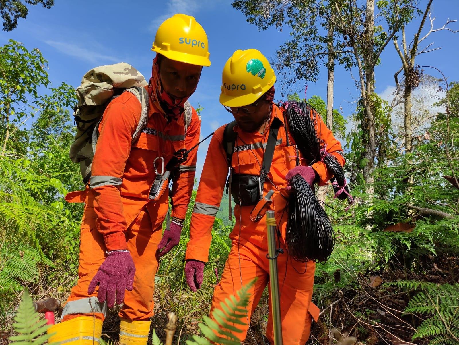
SUPRA International provides comprehensive groundwater exploration and hydrogeological consulting services integrating advanced geophysical methods, remote sensing technologies, and AI-powered data analytics. Our team supports industrial developments, municipal water supply programs, and agricultural projects across Indonesia through VES surveys, satellite-based monitoring, machine learning applications, and sustainable resource management planning tailored to diverse geological and climatic contexts.
Need expert groundwater exploration and resource assessment services?
Contact us to discuss your project requirements, exploration methodologies, and sustainable development strategies
Share:
If you face challenges in water, waste, or energy, whether it is system reliability, regulatory compliance, efficiency, or cost control, SUPRA is here to support you. When you connect with us, our experts will have a detailed discussion to understand your specific needs and determine which phase of the full-lifecycle delivery model fits your project best.